

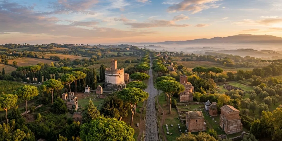
Rome did not conquer the ancient world with swords alone. It conquered it with roads. The Cesta Romana, the vast network of roads built by the Roman Empire, was the single most powerful piece of infrastructure the ancient world ever produced. Without it, there would have been no empire to speak of.
Cesta Romana refers to the ancient Roman road system, a network of engineered stone highways that stretched over 400,000 kilometers across Europe, North Africa, and parts of Asia. Built from around 312 BCE onward, these roads served the military, trade, communication, and governance of the Roman Empire. Today, many modern roads still follow their original routes.
Quick Facts: Cesta Roman at a Glance
| Feature | Detail |
|---|---|
| Modern term | Cesta Roman (from Latin “via” or “viae Romanae”) |
| First major road | Via Appia, built in 312 BCE |
| Total network length | Over 400,000 km (approx. 250,000 miles) |
| Primary builder | Roman Republic, then Roman Empire |
| Original purpose | Military troop movement |
| Secondary uses | Trade, postal service, cultural exchange |
| Road width (standard) | Approximately 4.5 meters (15 feet) |
| Famous milestone | Milliarium Aureum, placed in 20 BCE by Augustus |
| Via Appia’s UNESCO status | Inscribed as World Heritage Site in July 2024 |
| Regions covered | Europe, North Africa, Western Asia |
| Postal system using roads | Cursus Publicus (established by Augustus) |
| Modern roads following Roman routes | Hundreds across Italy, France, Spain, and the UK |
What Is Cesta Roman?
The phrase “cesta Roman” combines the word “cesta,” meaning “road” or “path” in several European languages, with “Roman,” pointing directly to ancient Rome. Together, they describe one of the greatest infrastructure systems in human history.
The Romans themselves called their roads viae Romanae in Latin, or simply “via” for a single road. The modern phrase “cesta roman” emerged as different cultures interpreted Roman achievements through their own languages. It is now widely used in online searches and articles to describe this ancient road network.
Think of “cesta román” as a modern shorthand. It helps anyone, anywhere, talk about Roman roads without needing Latin. And it points to something far bigger than just gravel and stone.
The Origins of Cesta Roman: How It All Started
The story of Cesta Romana begins around the 4th century BCE, during the early Roman Republic. At that time, travel across the Italian Peninsula meant navigating rough dirt tracks that turned into muddy rivers during rain. Armies struggled, messengers were delayed, and trade moved at a crawl.
Rome needed a solution. And in 312 BCE, a Roman official named Appius Claudius Caecus ordered the construction of the Via Appia. This road connected Rome to Capua, roughly 212 kilometers to the south. It later extended all the way to Brindisi, opening a route to the eastern Mediterranean.
The Via Appia was built to solve a real military problem. Rome was fighting the Third Samnite War and needed fast troop movement. The road delivered. It was also the first major paved road in Roman history and set the standard for everything that came after.
That single decision in 312 BCE launched what would become the most connected road network the ancient world had ever seen.
How Big Was the Cesta Roman Network?
Here is where the numbers get staggering. At its peak, the Cesta Romana network covered over 400,000 kilometers of roads, including both major highways and smaller regional routes. Some estimates for the paved, primary road network alone sit at around 80,000 kilometers.
To picture that distance, 400,000 kilometers is roughly ten times around the Earth at the equator.
These roads spread across the following:
- The entire Italian Peninsula
- Modern-day France, Spain, and Portugal
- Britain, from London to the Scottish border
- North Africa, including present-day Morocco, Libya, and Egypt
- Eastern Europe through the Balkans
- Parts of modern Turkey, Syria, and the Middle East
Every major city and province in the empire connected back to Rome through this network. It was not just roads. It was a nervous system for an entire civilization.
Why Does Cesta Roman Matter? The Three Big Reasons
You might ask why ancient roads deserve this much attention. Here is why Cesta Roman changed history in three very specific ways.
Military Speed and Control
Roman legions could march up to 30 kilometers per day on well-maintained roads. Imperial couriers using the cursus publicus, Rome’s official postal service, could cover up to 80 kilometers in a single day with fresh horses at relay stations. Compare that to off-road travel, which might cover 10 kilometers in the same time across rough terrain.
If there was a revolt in Britain, Rome knew about it faster. If an army needed to reach the Rhine River, it arrived sooner. Speed meant control.
Trade and Economic Growth
Merchants used the cesta romana to carry grain from Egypt, wine from Gaul, olive oil from Spain, and silk from the eastern trade routes. Goods moved faster, arrived in better condition, and reached more markets. This boosted the empire’s economy in a direct and measurable way.
Imagine a merchant in Lyon wanting to sell wool in Rome. Without good roads, that journey would take weeks and carry huge risk. With Cesta Roman, the journey became reliable, predictable, and profitable.
Communication and Governance
Augustus established the cursus publicus, the imperial postal service, specifically because the road network made it possible. This two-tier system included mutationes, which were way stations every 8 to 12 miles where couriers swapped horses, and mansiones, which were full inns every 20 to 30 miles with stables, food, and lodging.
Laws, decrees, and military orders moved across the empire at remarkable speed for the ancient world. That is how Rome governed millions of people across millions of square kilometers.
How Were Cesta Roman Roads Built? The Engineering Explained
The Surveying Process
Roman engineers did not guess. Before building anything, they surveyed the land using a tool called a groma, a vertical pole with a horizontal cross and hanging plumb lines. By sighting along these lines, surveyors plotted perfectly straight routes across hills, valleys, and forests.
Roman roads favored straight lines above almost everything else. Straight roads reduced travel distance and allowed soldiers to see far ahead. If a hill was too steep, engineers used gradual zigzags to manage the grade. If a river blocked the route, they built a bridge.
The Four Layers of a Roman Road

A fully paved Roman road, called a via munita, used four distinct layers of material. Each layer had a specific purpose.
- Statumen: The bottom layer, made of large flat stones, is set deep into the earth to form a solid foundation.
- Rudus: A layer of concrete made from broken stone and lime mortar, poured on top of the stratum.
- Nucleus: A finer concrete layer of gravel, coarse sand, and lime, which smoothed out the surface.
- Summum dorsum: The top surface, made from tightly fitted polygonal basalt slabs on major roads or compacted gravel on smaller ones.
The surface was always slightly curved in the center, a shape called a camber. This pushed rainwater off the road and into side ditches. Roads stayed dry. Damage from water was minimized. That one detail alone explains why some Cesta Roman surfaces survived 2,000 years of weather.
Milestones: Rome’s Navigation System
Every Roman mile along the Cesta Romana network, roughly 1,480 meters, featured a stone column called a milestone. These columns displayed the distance to the nearest major city and often named the emperor who paid for the road.
The most famous of all was the Milliarium Aureum, the Golden Milestone. Augustus placed it at the Roman Forum in 20 BCE. It was a gilded bronze column inscribed with distances to all major cities in the empire. This was the literal origin of the phrase “all roads lead to Rome.” Fragments of its base still survive near the Temple of Saturn today.
The Famous Roads of the Cesta Roman Network

Not all roads in the Cesta Romana network carried equal weight. Some became legendary.
Via Appia: The Queen of Roads
Built in 312 BCE by Appius Claudius Caecus, the Via Appia was the first and most celebrated road in Roman history. The 6th-century historian Procopius, writing nearly 900 years after its construction, described the basalt slabs as fitting so tightly they appeared to have “grown together rather than been set by hand.” In July 2024, UNESCO formally inscribed the Via Appia on its World Heritage list, making it the first ancient road in the world to receive that distinction.
Via Flaminia
The Via Flaminia connected Rome north to the Adriatic coast. It remains one of the most studied roads in the network. The Furlo Pass tunnel on the Via Flaminia, cut by Emperor Vespasian’s engineers in AD 77, is still in use today as part of the modern Italian state highway system. That is a 1,950-year-old piece of engineering handling 21st-century traffic.
Via Egnatia
This road stretched from the Adriatic coast of Greece eastward through the Balkans to Byzantium, the city that would later become Constantinople. It served as the empire’s primary east-west corridor and carried both armies and merchants for centuries.
Via Aurelia
Running along Italy’s western Tyrrhenian coastline toward Gaul, the Via Aurelia supported coastal trade and military defense. Many modern roads in Tuscany and Liguria trace their exact path.
Cesta Roman and the Cursus Publicus: Rome’s Postal Network
One aspect of Cesta Romana that most articles barely mention is the cursus publicus, the imperial postal and transport system. Augustus created it specifically to exploit the road network’s capabilities.
The cursus publicus worked on two tiers. Mutationes were small stations where official couriers swapped tired horses for fresh ones. Mansions were full stopping points with baths, kitchens, sleeping quarters, and stables. A government courier with access to this system could cover 80 kilometers per day. By contrast, a private traveler without these privileges might manage 30 to 40 kilometers.
Think of the cursus publicus as the Roman version of a national express courier service, built entirely on the roads of the Cesta Romana. It kept the empire informed and connected in a way no other civilization of that era achieved.
How Cesta Roman Spread Culture Across Continents
Language and the Spread of Latin
Soldiers, merchants, and officials traveled the Cesta Romana constantly. Wherever they went, they brought Latin with them. Over time, Latin mixed with local languages along these roads and slowly became the foundation for modern French, Spanish, Italian, Portuguese, and Romanian. Roads did not just carry goods. They carried the seeds of entire languages.
Christianity and the Road Network
Early Christian missionaries used the cesta romana to move quickly between communities. The Apostle Paul traveled Roman roads across Asia Minor, Greece, and Italy to spread Christianity. The road to Rome was not just a route. It was an artery for a new belief system that would shape Western civilization.
Towns Born from Cesta Roman
Hundreds of towns across Europe owe their existence to the cesta romana. When roads passed through a location, inns, markets, and rest stops grew there. Those clusters of buildings became villages. Villages became towns. You can see this pattern in place names today. Many British towns ending in “-chester” or “-cester,” such as Winchester and Leicester, grew from Roman military camps along roads. The Latin word “castrum,” meaning fort, evolved into those endings over centuries.
What Did Roman Road Travel Actually Look Like?
Here is a detail competitors miss entirely. Traveling the Cesta Romana was not simple or comfortable for most people.
Wealthy Romans traveled in covered carriages with slaves and porters. Government officials used the cursus publicus and had access to fresh horses and mansiones with baths. Most ordinary travelers walked or rode horses, and travel was slow and sometimes dangerous.
Ancient route books helped travelers plan journeys. The Itinerarium Antonini, compiled during or after the Antonine period in the 2nd century CE, listed stations and distances across the empire. The Tabula Peutingeriana, a medieval copy of a Roman road map, shows routes, cities, rivers, and landmarks across the entire network. These documents are essentially Rome’s version of a GPS system, written on parchment.
Bandits were a real concern on lonely stretches. Groups often traveled together for safety. Some paid armed escorts. Inns along the roads ranged from comfortable mansiones to rough roadside taverns. Road travel was essential but demanded preparation.
Cesta Roman’s Decline: What Happened?
The Cesta Roman did not collapse overnight. It decayed slowly, as the Roman Empire weakened.
Maintaining 400,000 kilometers of road required enormous resources. Workers, funding, and organizational muscle all had to stay in place. When Rome began losing territory in the 3rd and 4th centuries CE, provincial governors could no longer fund repairs. Tax collection became irregular. Armies that once built roads during peacetime were stretched too thin.
Weather, heavy use, and neglect attacked the surfaces. Bridges fell. Drainage ditches clogged. Some sections became impassable. By the 5th century CE, when the Western Roman Empire finally collapsed, large portions of the network had fallen out of use.
But here is the remarkable part. The underlying construction was so sound that hundreds of sections survived. Medieval travelers still used stretches of the Cesta Romana centuries after Rome fell. Modern archaeologists still find intact Roman road layers under European city streets today.
Cesta Roman’s Legacy in 2026

The influence of Cesta Romana is not a distant history lesson. It is physically present around you right now, if you know where to look.
In Britain, the A2 road from London to Dover follows the ancient Roman road called Watling Street almost exactly. In Italy, the modern SS7 highway follows the Via Appia through parts of southern Italy. The Furlo Pass tunnel in Umbria, carved into a mountain by Roman engineers in 77 CE, still carries Italian traffic today.
Road construction principles developed for the Cesta Romana still inform modern engineering. The concept of a compacted base, a drainage layer, and a smooth wearing surface is essentially what modern road builders still use. The camber that kept Roman roads dry is still built into roads everywhere.
In 2026, historians, archaeologists, and engineers continue studying the Pont du Gard for practical lessons in infrastructure design and long-term maintenance. The Roman road system on Wikipedia remains one of the most referenced articles on ancient engineering. And the UNESCO World Heritage inscription of the Via Appia in July 2024 confirms that the global community still recognizes Cesta Romana as a priceless achievement.
Key Takeaways
- Cesta Roman refers to the ancient Roman road network, a system of over 400,000 kilometers of engineered highways connecting the Roman Empire.
- The first major road, the Via Appia, was built in 312 BCE and is now a UNESCO World Heritage Site, inscribed in July 2024.
- Roman roads used a four-layer construction method with a cambered surface for drainage, making them durable enough to survive over 2,000 years.
- The cursus publicus, Rome’s imperial postal service, used Cesta Roman roads to move couriers at up to 80 kilometers per day.
- Cesta and Roman spread the Latin language, Christianity, and trade goods across Europe, North Africa, and parts of Asia, shaping civilizations far beyond Rome’s borders.
- Many modern European roads, including highways in Italy, Britain, France, and Spain, follow the exact routes of the *Cesta Romana* established by Roman engineers.
Conclusion
Cesta Roman was never just about getting from one place to another faster. It was about building a civilization that could think and act as one unit across millions of square kilometers. Every stone laid for a Roman road was a decision to stay connected, stay organized, and stay powerful.
The roads moved armies. They moved merchants. They moved ideas. Latin traveled through them. Christianity traveled with them. An entire modern map of European civilization grew along their edges.
In 2026, the cesta romana still speaks. You hear it every time you drive on a straight highway through Tuscany or notice a British town named with “-chester” You see it in road construction textbooks that still reference Roman layering techniques. You feel it when UNESCO protects the Via Appia as a global treasure.
Strong infrastructure does not just serve an era. It shapes every era that follows. That is the real lesson of Cesta Romana. Build well, build smart, and what you create will outlast everything else.
Frequently Asked Questions About Cesta Roman
What does “cesta roman” mean in plain English?
“Cesta Romana” means “Roman roads” in Latin. The word “cesta” means “road” or “path” in several European languages, and “Roman” connects it to ancient Rome. It is a modern phrase used to describe the extensive road network built by the Roman Empire, which the Romans themselves called “viae Romanae” in Latin.
When did the Romans start building Cesta Romana roads?
The Romans started building roads in the early 4th century BCE. The first major paved road in the Roman network was the Via Appia, ordered by Appius Claudius Caecus in 312 BCE. Earlier roads before this date existed but were simple compacted dirt tracks without proper engineering.
How were Cesta Roman roads built to last so long?
Cesta Roman roads were built in four layers: a deep stone foundation called the “statumen,” a concrete middle layer called the “rudus,” a finer concrete layer called the “nucleus,” and a fitted stone or gravel top surface. The road surface was also curved slightly in the center so rainwater ran off the sides. This drainage design prevented water damage and is the main reason many sections survived over 2,000 years.
What was the cursus publicus, and how did it use the Cesta Romana?
The cursus publicus was Rome’s official imperial postal and transport service, established by Emperor Augustus. It used the Cesta Romana road network and placed two types of stations along all major routes. Mutations were small relay points every 8 to 12 miles where couriers changed horses. Mansions were full inns every 20 to 30 miles with food, baths, and overnight lodging. Government couriers using this system could cover up to 80 kilometers in a single day.
Are any Cesta Romana roads still in use today?
Yes. Several modern roads directly follow ancient Cesta Romana routes. In Italy, the modern SS7 highway traces parts of the Via Appia. In Britain, the A2 road from London to Dover follows the route of the Roman road Watling Street. The Furlo Pass tunnel on the Via Flaminia, cut by Roman engineers in 77 CE, is still part of the Italian state highway system today, nearly 1,950 years after it was built.
Why did the Cesta Romana roads eventually fall into disrepair?
Maintaining 400,000 kilometers of road required constant funding, workers, and political organization. As the Roman Empire weakened from the 3rd century CE onward, provincial funding dried up, repair crews stopped working, and infrastructure started decaying. Drainage ditches clogged, bridges failed, and weather wore down surfaces. By the time the Western Roman Empire collapsed in 476 CE, large parts of the network had become unusable. However, the core construction was strong enough that many sections survived deep into the medieval period and even into the modern era.
Did the cesta Roman influence the spread of religion and language?
Absolutely. The Cesta Roman roads were the main corridors through which Latin spread across Europe, eventually forming the foundation of French, Spanish, Italian, Portuguese, and Romanian. Early Christian missionaries, including the Apostle Paul, used these roads extensively to travel between communities in Asia Minor, Greece, and Italy. Christianity’s rapid spread across the Roman Empire in the 1st and 2nd centuries CE was directly enabled by the road network.
How wide were the Cesta Roman roads?
Most standard Roman roads in the Cesta Romana network were approximately 4.5 meters wide, or about 15 feet. This allowed two chariots or wagons to pass each other comfortably. Major military and trade highways were sometimes wider, while secondary rural roads were narrower. Sidewalks and drainage ditches often flanked both sides of the main road surface.
READ MORE: Do Escritor: Full Meaning, Grammar, Literary Power, and Why It Matters in 2026
[…] READ MORE: Cesta Roman: The Complete Guide to Rome’s Road Network That Built an Empire 2026 […]